From Drone Flight to 3D Model
Transform a simple set of overlapping photos into centimeter-precise 3D models. Plan solar systems with unmatched accuracy — all within a single platform.
From drone flight to customer-ready proposal in under an hour.
Drone Flight
Capture overlapping images from multiple angles. A 10-minute flight is all it takes.
Upload & Verify
Upload images to Reonic. The system verifies coverage automatically.
3D Generation
Automated processing creates a high-resolution 3D model in 15–45 minutes.
Design & Propose
Plan your PV system on the 3D model and generate professional proposals.
Loved by our customers.
Loved by yours, too.
Since we started using photogrammetry, our workflow has noticeably improved. Planning has become significantly more efficient, panel placement more accurate, and our error rate has been reduced. And customers think it's fascinating.
Kagan Dogruluk
CEO, prev.end GmbH
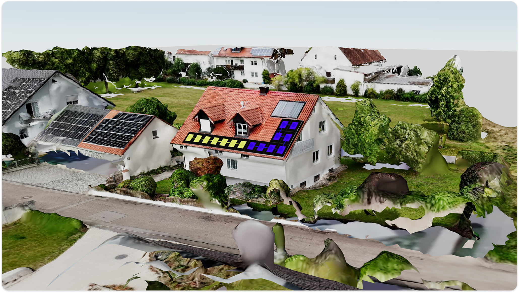
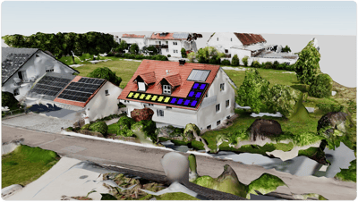
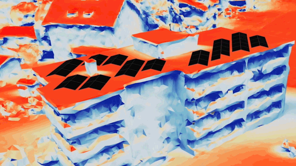
All roof angles, surfaces, and structures shown in full detail. No manual reconstruction required.
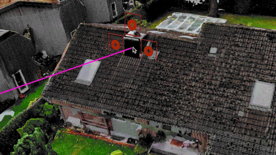
Obstacle Detection
Identify chimneys, vents, and skylights for efficient module placement.
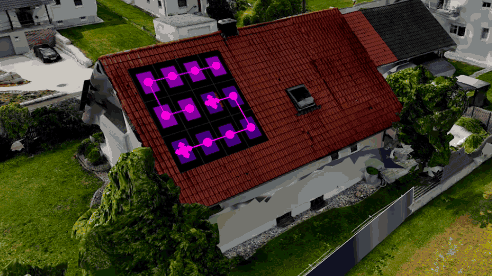
Shading Simulation
Model the sun's trajectory throughout the day and across seasons.
System Configuration
Choose modules, add strings and inverters, visualise the complete system.
How it works
Precision through mathematics, not estimation. Real-world coordinates from real images.
Triangulation
Camera positions and angles calculate real-world coordinates for every point.
Mesh Creation
Calculated points connect to form the structural framework of the 3D model.
Texture Mapping
Original photo textures applied to create a photorealistic digital twin.
Fast Mode: First models in 5 minutes
AI-optimised image selection and fast rendering delivers your first 3D model automatically. In the background, a high-resolution model is computed and seamlessly upgraded — wow your customers from the first minute.
Reonic makes photogrammetry effortless and fully integrated. No switching between tools, no exporting data back and forth, no separate subscriptions.
Automatic roof plane detection
Shading & solar path simulation
Module placement optimisation
Professional proposal generation
Compatible with popular consumer drones. No specialised equipment required.
DJI Mini 4 Pro
DJI Flip
DJI Mini 3 Pro
DJI Air 3S
DJI Mavic 3 Pro
DJI Air 3
DJI Mavic 3 Classic
DJI Air 2S
DJI Mavic 3
Mavic Air 2
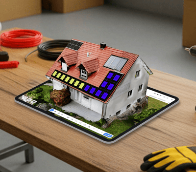
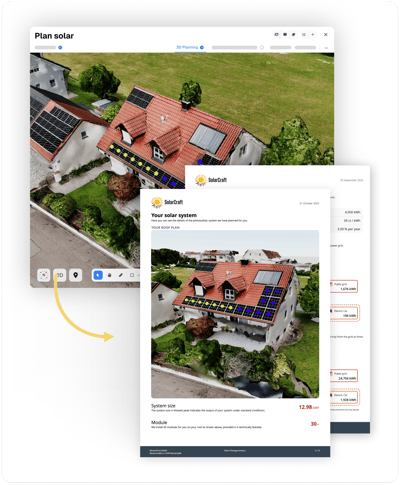
Your PV system design integrates directly into fully customisable, branded proposals that stand out from the competition.
Financial analysis
Comprehensive profitability analysis with ROI and savings calculations that give your customers confidence in their investment.
Energy simulation — projected energy production at a glance
Branded proposals
Fully customisable proposals with your branding that showcase climate impact, energy projections, and professional company presentation.
Custom branding — your logo, testimonials, and company presentation
Photogrammetry uses overlapping photos to create an accurate 3D model or orthophoto. By capturing a building from multiple angles, the software can triangulate the exact position of every visible point, creating a centimeter-precise digital replica — the perfect foundation for PV planning.
With Reonic, your 3D models are created without external software: upload images, wait 15–45 minutes, and continue planning directly in the same platform. This saves time, reduces errors, and eliminates the hassle of switching between tools or managing complicated import-export processes.
Any camera drone that provides georeferenced photos works well. We recommend a resolution of at least 12 MP and maintaining 70% overlap between images. Popular compatible models include the DJI Mavic 4 Pro, Mini 4 Pro, Air 3S, and many others in the DJI lineup.
With a bit of practice, the drone flight takes about 10 minutes. You then upload the images to Reonic, verify the data, and start the processing — after 15–45 minutes, the model is ready. This means you can have a complete 3D model ready for planning in under an hour, depending on the number of images.
Book a demo. Get to know all products and features.
In a personal product presentation, we'll show you all products and features. Free of charge, no obligation and tailored to your business and needs.
Book a demo